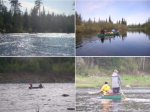
Saint John is the granddaddy of all Northern Maine rivers, all the other rivers up north eventually flow into the Saint John.
Water levels will vary wildly through the season with late spring being the time of choice for most canoeists to run the river. By mid June the river is generally too low to run until the late fall rains begin.
Ice-out is usually around April 15 and the river guage in Fort typically tops out at 24 feet.During the summer the gage goes down to as low as 1.5 feet.At this level it is possible to walk across the river in many places.
The weather in April and early May can be raw with rain, freezing weather at night and the occasional snow flurry. After mid May the weather moderates and you can expect to be kept company by black flies, mosquitoes and no-see-ums. Ideal stream flows are 3000 cubic feet per second and above as recorded at the Fort Kent river guage.
To check current conditions click here
The Appalachian Mountain club publishes an excellent guide to rivers which covers the Saint John trip in detail. Click here
Another very useful resource is the Delorme Maine Atlas and Gazeteer.
To purchase a copy: Click here
The upper St. John from 4th Saint John Pond to Allagash village is THE wilderness river trip in Maine with only the occasional log cabin.
From Allagash down, houses are visible from the river most of the way to Fort Kent. The upper river is remote and deserves respect due to the cold weather and water.
There are two rapids which can rise to Class III depending on flow levels. Big Black Rapids and Big Rapids in particular (two miles long) should be scouted.
Nine Mile Bridge, a book by Helen Hamlin, is an excellent account of life in the headwaters of the Saint John during the 1940s.
To buy a copy, http://www.amazon.com/Bridge-Three-Years-Maine-Woods/dp/096716625X/ref=sr_1_1?ie=UTF8&qid=1398452923&sr=8-1&keywords=helen+hamlinie=UTF8&qid=1398452579&sr=8-1&keywords=delorme+maine+atlas